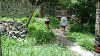
The Virgin Islands National Park on St. John offers an assortment of unique hiking trails. You can find an enjoyable 30-minute stroll through a shady forest or an invigorating full-day hike. St. John Hiking Tours and Excursions
Ram Head Trail
Southside - 1.8 Miles, Moderate
This trail begins at the south end of Salt Pond Bay Beach. This rocky trail leads to a blue cobble beach and then leads back up the hillside to...
Reef Bay Trail
Southside - 4.2 Miles, Challenging
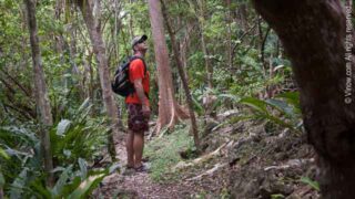
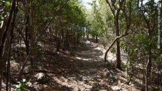
This trail begins on Centerline Road. The trail descends 937 feet through a shady forest. There is a variety of plant life to be seen while hiking. The visible...
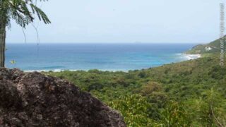
Caneel Hill Trail
Northside - 4.8 Miles, Difficult
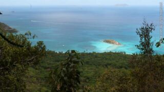
This trail joins Cruz Bay with Northshore Road entrance to Caneel Bay. The trail leads up to a scenic overlook atop Caneel Hill. The overlook is at an elevation...
Petroglyph Trail
Southside - .46 Miles, Moderate
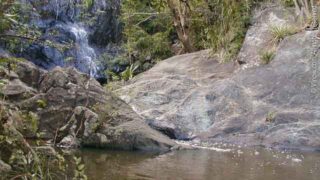
This trail starts 1.5 miles down the Reef Bay trail. Mysterious rock carvings are located at the end of the trail. In rainy season a small waterfall and stream...
Cinnamon Bay Trail
Nothside - 2 Miles, Moderate
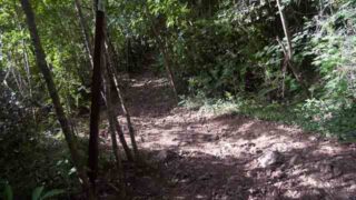
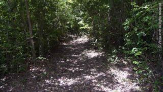
This trail begins around 100 yards east of the entrance to Cinnamon Bay Campground. This forested trail leads up an old Danish plantation road and junctions with Centerline Road....
Lind Point Trail
Nothside - 2.2 Miles, Easy
This trail connects the National Park Visitor Center in Cruz Bay with Honeymoon Beach and Caneel Bay. The trail ascends .4 miles to the scenic Lind Point overlook. The...
Cinnamon Bay Self-Guiding Trail
Nothside - .5 Miles, Easy
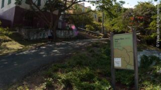
This trail passes through sugar plantation ruins and forested areas. Placards and signs along the trail indicate historical and environmental points of interest. The trail begins near the entrance...
Bordeaux Mountain Trail
Southside - 2.4 Miles, Difficult
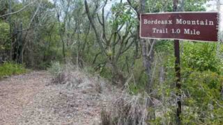
This is a steep, open to the sun trail. It connects the shady Bordeaux Mountain Road with Lameshur Bay 1,000 feet below. Bordeaux Mountain is the highest point...
Leinster Bay Trail
Northside - 1.6 Miles, Easy
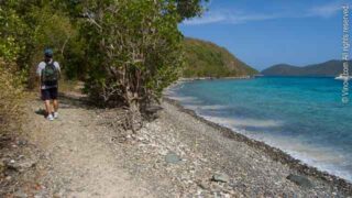
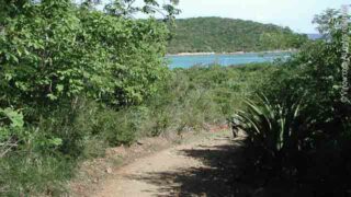
The trail follows the old Danish Road eastward along the shore from the Annaberg picnic area to Waterlemon Bay. This is a good place to swim. Snorkeling at Waterlemon...
Francis Bay Trail
Northside - 1.6 Miles, Easy

This trail begins at the west end of the Mary Creek road. The trail passes through a dry forest and leads past the Francis Bay Estate House and onto...
Brown Bay Trail
East End - 3.2 Miles, Challenging
The National Park cautions that this trail is NOT maintained! The trail begins from the ridge 0.7 miles out of Johnny Horn trail from Waterlemon Bay. The trail branches...
Peace Hill
Northside - 0.2 Miles, Moderate
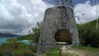
This short trail leads to a scenic grassy flat overlook with an old sugar mill tower. A road/parking area just off of Northshore road is the beginning point of...
Drunk Bay Trail
Southside - 0.25 Miles, Easy
This trail begins at the south end of Salt Pond Bay Beach and turns to the east along the north side of the salt pond. In the past salt...
Europa Bay Trail
Southside - 0.5 Miles, Moderate
There are two trails that lead to Europa Bay area. Coming from the Reef Bay Trail on the Lameshur Bay Trail, at about 1.2 miles you come to the...
Lameshur Bay Trail
Southside - 3 Miles, Moderate
This trail connects Lameshur Bay with Reef Bay trail. The hiking is through dry, open forest. 1.2 miles from the Reef Bay junction a spur trail leads 0.3 miles...
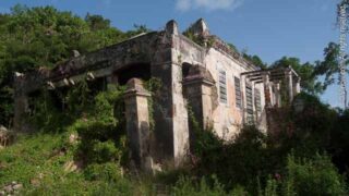
Annaberg School Area
Northside - 0.2 Miles, Easy
This trail leads to ruins of one of the Caribbean's oldest public school houses. The school offers great views of Mary Point, Leinster Bay and Tortola. ...
Turtle Point Trail
Northside - 0.6 Miles, Easy
Trail begins at the north end of the Caneel Bay Plantation. Hikers on this trail should enter the property and register at the front desk.
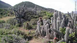
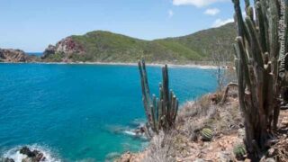
Salt Pond Bay Trail
Southside - 0.5 Miles, Moderate
This trail begins at the parking area 3.9 miles south of Coral Bay. The trail leads down to Salt Pond Beach through cactus and scrubland. There is good snorkeling...
Johnny Horn Trail
East End - 3.6 Miles, Moderate
This trail begins at Waterlemon Bay and crosses the ridges southward to the paved road at Emmaus Moravian Church in Coral Bay. The trail passes through sunny, dry forest....
Water Catchments Trail
Northside - 1.6 Miles, Challenging
This trail leads between Centerline Road and Northshore Road. The trail joins the Caneel Hill trail over a portion of its route.
Caneel Hill Spur Trail
Northside - 0.8 Miles, Challenging
This trail starts from Lind Point trail. It crosses Northshore Road at an overlook of Cruz bay and Caneel Bay. It joins the Caneel Hill trail at .4 miles...
Yawzi Point Trail
Southside - 0.6 Miles, Easy
This trail leads from Little Lameshur Bay Road through thorny vegetation to isolated coves.